

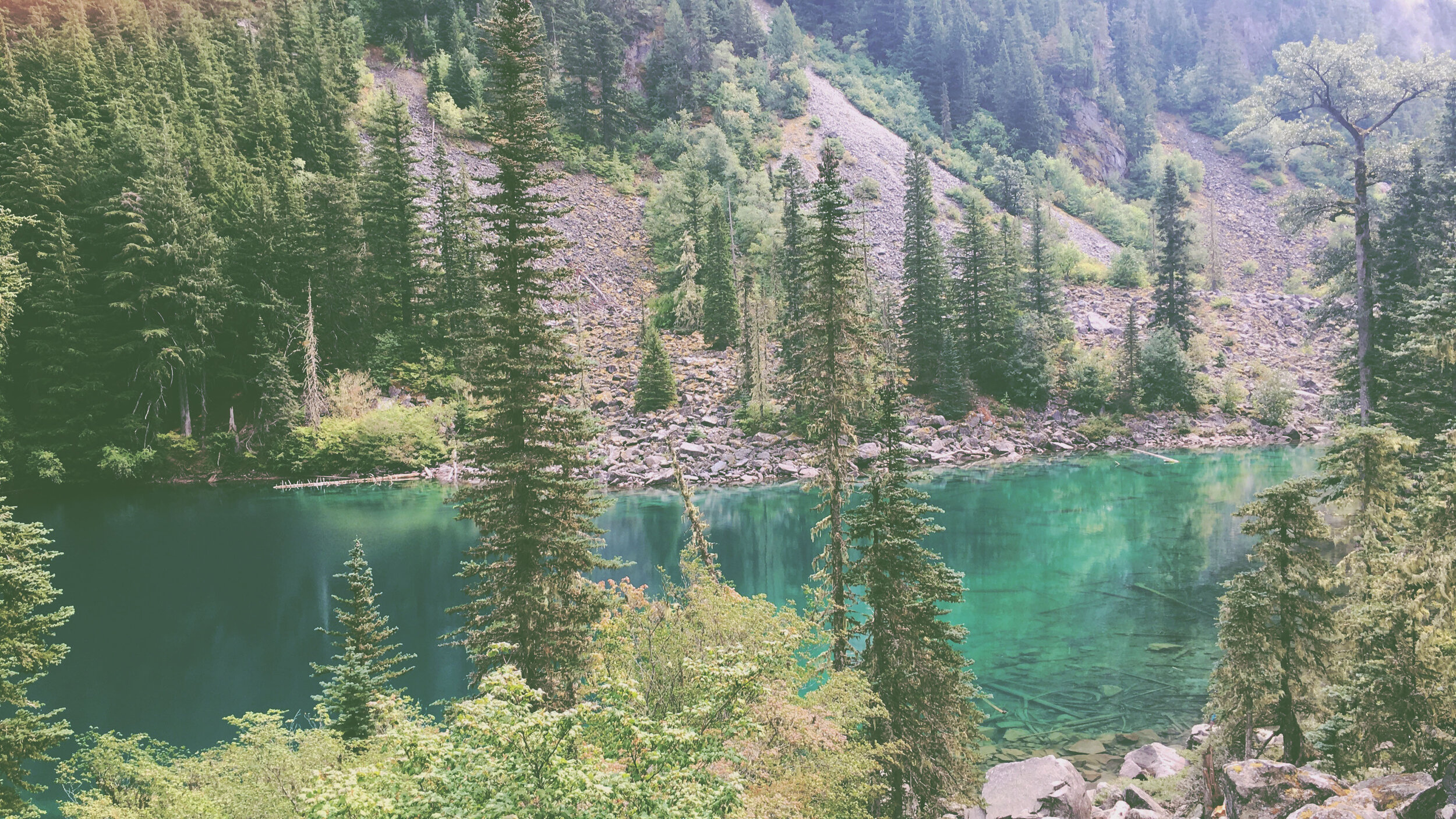
Lindeman Lake is THE perfect summertime hike in the Fraser Valley. And that really says something because there are A LOT of beautiful hikes out this way. But on a hot day, nothing beats it. Here’s why: it’s short (3.4km) but it’s steep (300 meters) so even though it only takes a couple hours it’ll get your heart pumpin’, and when you reach the top you’ll be greeted by a gorgeous turquoise lake. In our opinion, nothing is better than a hike that ends in a swim in a beautiful lake in the mountains (even if it is a little chilly!)
Not only is Lindeman Lake a great day-hiking location, it’s also a great camping spot! At the lake there are several tent pads available for those interested in spending the night. And for those looking for a little more to explore you can continue on beyond Lindeman Lake to Greendrop Lake, adding an additional 6 km to your exploration...
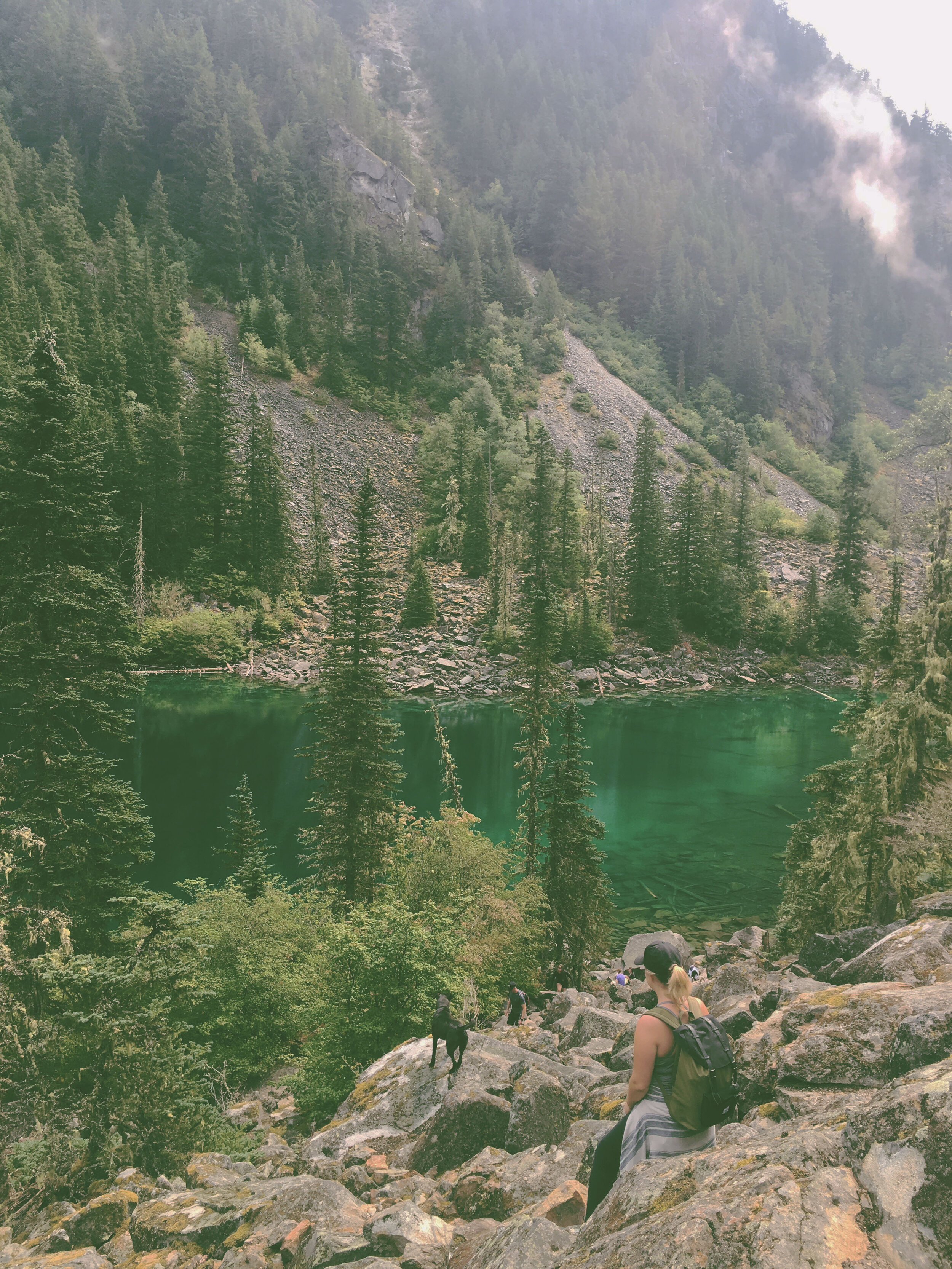
One thing to note about Lindeman Lake is that it’s busy, very busy. We’re not the only ones that are BIG fans of this hike. We recommend heading there early in the morning or on a weekday if you can to avoid an overcrowded trail.
Hiking Stats
Difficulty: Intermediate
Time: 2 hours
Round-Trip: 3.4km
Elevation Gain: 300 meters
Season: May - October
Dog Friendly: Yes
Getting There
To reach the trailhead from our Tasting Room (because you definitely want to stock up on some beers before you head out 😉) head East on South Sumas Road towards Evans Rd for 1.1km. Then, turn right onto Tyson Rd. In 800 meters you will come to a roundabout, take the second exit and stay on Tyson Rd. In 850 meters you’ll come across a second roundabout, take the third exit onto Keith Wilson Road. In 1.1km turn right onto Vedder Road. In 700 meters you’ll come across a third roundabout, take the second exit onto Chilliwack Rd and follow this road for 39.5km. Eventually the paved road turns to gravel and you’ll see a sign on the right side of the roads that points to the Lindeman Lake trailhead which begins on the left side.

Hiking Route
From the parking lot you will find a Chilliwack Lake Park map and an outhouse, the map outlines the trail to Lindeman Lake and the other hikes in the area. From the outhouse, follow the wide path down and you will come to a junction, stay straight on the trail marked for Lindeman Lake.
Soon, you’ll come across Post Creek, which both feeds and drains from Lindeman Lake. The creek will remain on your left as you continue to hike up the trail. Soon after this, the trail enters the trees and becomes more technical with many large rocks which might slow you down a little.
Soon you will cross over a log bridge. At this point the trail is mostly flat but at around 600 meters into your hike it’ll begin to climb.
At 1km into the hike the trail becomes even steeper and as you approach the lake there is one particularly steep section, be careful on loose dirt!
Soon, you will begin to see the trees thin out and likely feel a cool breeze on your very sweaty face as you look out over the turquoise waters of Lindeman Lake. WORTHHH IT. At this point, we highly recommend taking in your surroundings, treating yourself to a cold one and taking a dip.
Enjoy some time relaxing by the lake and when you’re ready to head back down, follow the same path you came up.

Happy exploring friends! #YourstoExplore